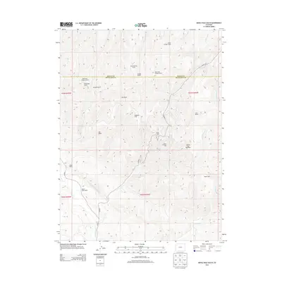
2013 Map of Devils Hole Gulch
USGS Topo · Published 2013About this map
Wilson Creek Oil Field and the nearby Wilson Creek Camp anchor this landscape along the border of Moffat and Rio Blanco counties. The topography is defined by the high elevations of the Danforth Hills, where prominent landmarks such as Old Baldy and Devils Hole Mountain overlook a complex system of drainages. The map reveals the industrial infrastructure of the early 21st century, centered on energy extraction and the rugged road network of CO Road 9. Narrow canyons and gulches, including Chokecherry Gulch and Cave Gulch, segment the terrain, while the open space of Teepee Park provides a break in the high-country relief. Water features like Wilson Cr and Strawberry Cr carve paths through the Danforth Hills, illustrating the hydrological patterns of this western Colorado region.
Find a feature on this map
31 named features on this map. Tap any name to fly to it.
Don’t see what you’re looking for? This feature index may not catch every label — zoom into the map to look around manually.
Map Details
Editions of this 2013 Devils Hole Gulch Map
This is the sole edition of this map. No revisions or reprints were ever made.
Other maps of this area

1907 · White River
USGS Topo · 1:125,000

1910 · Danforth Hills
USGS Topo · 1:125,000

1910 · White River
USGS Topo · 1:125,000

1912 · Meeker
USGS Topo · 1:62,500

1912 · Axial
USGS Topo · 1:62,500

1914 · Meeker
USGS Topo · 1:62,500

1914 · Axial
USGS Topo · 1:62,500

1954 · Vernal
USGS Topo · 1:250,000

1954 · Craig
USGS Topo · 1:250,000

1957 · Craig
USGS Topo · 1:250,000