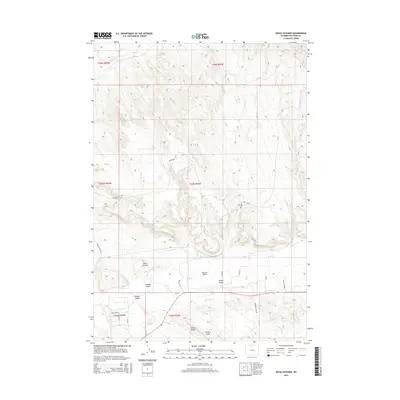
2015 Map of Devils Kitchen
USGS Topo · Published 2015About this map
Devils Kitchen anchors this landscape in Big Horn County, characterized by a complex network of geological formations and water management systems. The terrain is defined by a series of significant drainage features, including Sheldon Gulch, Scharen Gulch, and Herren Gulch, which lead toward the larger valley of Shell Cr. To the south, Potato Ridge and Potato Draw rise above a high desert floor, marked by industrial and agricultural development.
Find a feature on this map
33 named features on this map. Tap any name to fly to it.
Don’t see what you’re looking for? This feature index may not catch every label — zoom into the map to look around manually.
Map Details
Editions of this 2015 Devils Kitchen Map
This is the sole edition of this map. No revisions or reprints were ever made.
Other maps of this area

1898 · Bald Mountain
USGS Topo · 1:125,000

1901 · Bald Mountain
USGS Topo · 1:125,000

1955 · Cody
USGS Topo · 1:250,000

1955 · Sheridan
USGS Topo · 1:250,000

1958 · Cody
USGS Topo · 1:250,000

1958 · Sheridan
USGS Topo · 1:250,000

1960 · Manderson NE
USGS Topo · 1:24,000

1960 · Devils Kitchen
USGS Topo · 1:24,000

1960 · Shell
USGS Topo · 1:24,000

1960 · Bear Creek Ranch
USGS Topo · 1:24,000