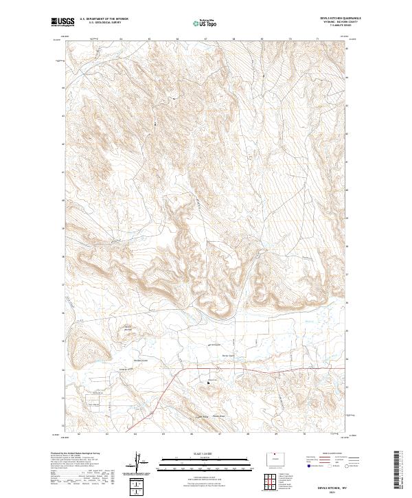
2021 Map of Devils Kitchen
USGS Topo · Published 2021About this map
Devils Kitchen defines the northern reaches of this Big Horn County landscape, where the high desert terrain is carved by a complex network of gulches and draws. The southern half of the map reveals a sophisticated irrigation system essential to the region's agricultural life, featuring the Porter Canal, Shell Canal, and Thompson Lateral. These waterways, along with the Whaley Ditch, redirect the flow of Shell Cr to support local ranching and farming operations.
Find a feature on this map
32 named features on this map. Tap any name to fly to it.
Don’t see what you’re looking for? This feature index may not catch every label — zoom into the map to look around manually.
Map Details
Editions of this 2021 Devils Kitchen Map
This is the sole edition of this map. No revisions or reprints were ever made.
Other maps of this area

1898 · Bald Mountain
USGS Topo · 1:125,000

1901 · Bald Mountain
USGS Topo · 1:125,000

1955 · Cody
USGS Topo · 1:250,000

1955 · Sheridan
USGS Topo · 1:250,000

1958 · Cody
USGS Topo · 1:250,000

1958 · Sheridan
USGS Topo · 1:250,000

1960 · Manderson NE
USGS Topo · 1:24,000

1960 · Devils Kitchen
USGS Topo · 1:24,000

1960 · Shell
USGS Topo · 1:24,000

1960 · Bear Creek Ranch
USGS Topo · 1:24,000