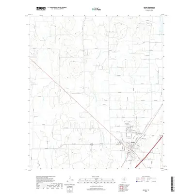
2019 Map of Devine
USGS Topo · Published 2019About this map
Devine serves as the primary hub of this south Texas landscape, characterized by a complex network of county roads and creek systems. The community is flanked by important local landmarks, including the Devine Municipal Airport and multiple burial grounds like Saint Evergreen Cem and Josephs Cem. The hydrology of the area is defined by the winding paths of San Francisco Perez Cr and Burnt Boot Cr, which drain toward the larger Chacon Cr system. To the north and east, Jungman Lake and Chicon Lake provide localized water sources within the terrain. The map captures the interface between the structured grid of the town and the agricultural tracts accessed by routes like FM 1343 and Big Key Rd, reflecting the modern rural infrastructure of Medina County.
Find a feature on this map
105 named features on this map. Tap any name to fly to it.
Don’t see what you’re looking for? This feature index may not catch every label — zoom into the map to look around manually.
Map Details
Editions of this 2019 Devine Map
This is the sole edition of this map. No revisions or reprints were ever made.
Other maps of this area

1942 · Natalia
USGS Topo · 1:62,500

1954 · San Antonio
USGS Topo · 1:250,000

1956 · New Fountain
USGS Topo · 1:62,500

1957 · San Antonio
USGS Topo · 1:250,000

1958 · La Coste
USGS Topo · 1:24,000

1964 · Ghost Hill
USGS Topo · 1:24,000

1964 · Castroville
USGS Topo · 1:24,000

1964 · Devine
USGS Topo · 1:24,000
1964 · Moore
USGS Topo · 1:24,000
1964 · Lytle
USGS Topo · 1:24,000