2022 Map of Devine
USGS Topo · Published 2022About this map
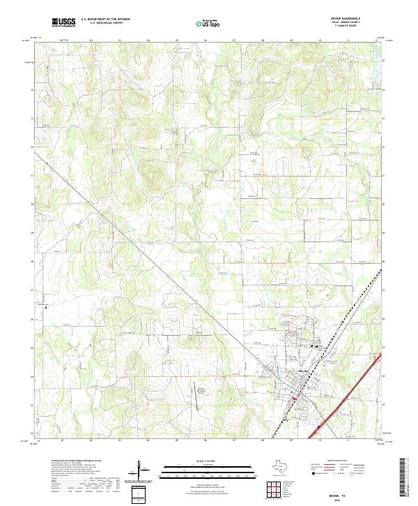
The southern Medina County landscape surrounding Devine is defined by a dendritic network of seasonal drainages, where the San Francisco Perez Cr and Burnt Boot Cr converge south of the primary settlement. The town itself exhibits a concentrated grid pattern, serving as a hub for the surrounding ranching and agricultural lands. To the north and west, the terrain becomes more varied with numerous county roads such as Co RD 661 and FM 1343 providing access to outlying properties. Genealogists and local historians will find several significant burial grounds documented, including the Devine Evergreen Cem and the Saint Joseph Catholic Cem on the town's eastern edge, as well as the more isolated Roberson Cem to the west. Water features like Jungman Lake and Chicon Lake stand out in the northern sector, indicating the vital role of water management in this South Texas environment.
Find a feature on this map
110 named features on this map. Tap any name to fly to it.
Don’t see what you’re looking for? This feature index may not catch every label — zoom into the map to look around manually.
Map Details
Editions of this 2022 Devine Map
This is the sole edition of this map. No revisions or reprints were ever made.