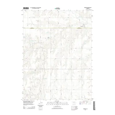
2014 Map of Deweese
USGS Topo · Published 2014About this map
Deweese sits at the northern edge of the Nuckolls Co and Clay Co border, positioned just south of the Little Blue River. The surrounding landscape is defined by an extensive drainage network feeding into the river, including Liberty Cr, Dry Cr, and Walnut Cr. This 2014 survey reveals a rural territory where water management is central to the land's utility, evidenced by several family-named impoundments such as Hubl Reservoir, Mazour Reservoir, and Pohlmeier Reservoir.
Find a feature on this map
38 named features on this map. Tap any name to fly to it.
Don’t see what you’re looking for? This feature index may not catch every label — zoom into the map to look around manually.
Map Details
Editions of this 2014 Deweese Map
This is the sole edition of this map. No revisions or reprints were ever made.
Other maps of this area

1898 · Superior
USGS Topo · 1:125,000

1955 · Grand Island
USGS Topo · 1:250,000

1957 · Grand Island
USGS Topo · 1:250,000

1958 · Grand Island
USGS Topo · 1:250,000
1960 · Fairfield SE
USGS Topo · 1:24,000

1960 · Deweese
USGS Topo · 1:24,000

1969 · Fairfield NW
USGS Topo · 1:24,000

1969 · Lawrence
USGS Topo · 1:24,000
1969 · Fairfield
USGS Topo · 1:24,000
1969 · Pauline
USGS Topo · 1:24,000