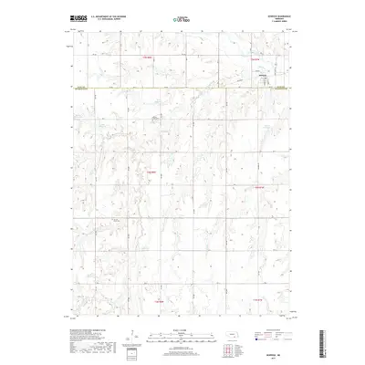
2017 Map of Deweese
USGS Topo · Published 2017About this map
The Little Blue River and Liberty Cr carve a path through this section of south-central Nebraska, where the village of Deweese serves as a small hub along the northern border. This 2017 snapshot of Clay and Nuckolls Counties reveals a landscape shaped by both water and agricultural infrastructure, evidenced by several family-named impoundments including Hubl Reservoir, Skalka Reservoir, and Pohlmeier Reservoir. The presence of the Railroad and State Spur 18C near the village highlights the area's continued reliance on transportation corridors established in previous generations.
Find a feature on this map
48 named features on this map. Tap any name to fly to it.
Don’t see what you’re looking for? This feature index may not catch every label — zoom into the map to look around manually.
Map Details
Editions of this 2017 Deweese Map
This is the sole edition of this map. No revisions or reprints were ever made.
Other maps of this area

1898 · Superior
USGS Topo · 1:125,000

1955 · Grand Island
USGS Topo · 1:250,000

1957 · Grand Island
USGS Topo · 1:250,000

1958 · Grand Island
USGS Topo · 1:250,000
1960 · Fairfield SE
USGS Topo · 1:24,000

1960 · Deweese
USGS Topo · 1:24,000

1969 · Fairfield NW
USGS Topo · 1:24,000

1969 · Lawrence
USGS Topo · 1:24,000
1969 · Fairfield
USGS Topo · 1:24,000
1969 · Pauline
USGS Topo · 1:24,000