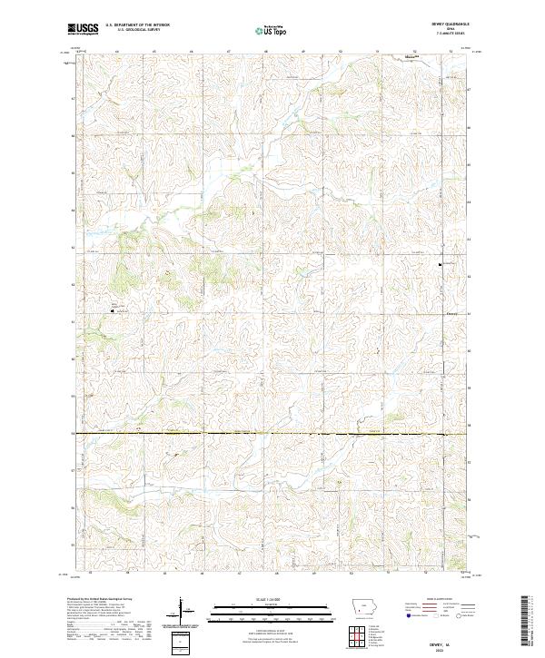
2022 Map of Dewey
USGS Topo · Published 2022About this map
Rolling agricultural uplands and a network of named prairie creeks characterize the landscape where Cass Co Adams Co meet. The northern edge of the map features the outskirts of Massena, while the rural interior is defined by family-named landmarks and historical sites. Genealogists will find the Victoria Cem and Saint Timothy Cem particularly useful, as they are situated along the secondary road network of Wichita Rd and 750th St.
Find a feature on this map
47 named features on this map. Tap any name to fly to it.
Don’t see what you’re looking for? This feature index may not catch every label — zoom into the map to look around manually.
Map Details
Editions of this 2022 Dewey Map
This is the sole edition of this map. No revisions or reprints were ever made.
Other maps of this area

1954 · Omaha
USGS Topo · 1:250,000

1957 · Omaha
USGS Topo · 1:250,000

1958 · Omaha
USGS Topo · 1:250,000

1971 · Anita SW
USGS Topo · 1:24,000

1971 · Massena
USGS Topo · 1:24,000

1971 · Fontanelle SW
USGS Topo · 1:24,000

1980 · Corning North
USGS Topo · 1:24,000

1980 · Grant
USGS Topo · 1:24,000

1980 · Bridgewater
USGS Topo · 1:24,000
1980 · Carbon
USGS Topo · 1:24,000