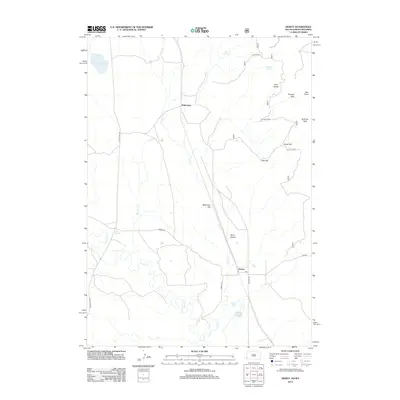
2012 Map of Dewey
USGS Topo · Published 2012About this map
Dakoming and Dewey sit along the border of Wyoming and South Dakota, illustrating the transition from the high plains into the Black Hills foothills. This 2012 survey captures the rugged drainage patterns of Line Cr and Beaver Cr, which carve through the landscape near Wyoming Hill. High points like Elk Mountain and Sullivan Peak dominate the eastern portion of the quadrangle, while the passage through Clifton Gap in the north suggests the strategic natural corridors used by early travelers. The transportation network is anchored by Old US Hwy 85 and Dewey Rd, connecting these remote ranching and border communities. Natural water sources such as Carr Spring and Baltzly Spring provide vital lifeblood in this arid terrain, marking points of historical importance for local land use and settlement.
Find a feature on this map
22 named features on this map. Tap any name to fly to it.
Don’t see what you’re looking for? This feature index may not catch every label — zoom into the map to look around manually.
Map Details
Editions of this 2012 Dewey Map
This is the sole edition of this map. No revisions or reprints were ever made.
Other maps of this area

1896 · Harney Peak
USGS Topo · 1:125,000

1899 · Newcastle
USGS Topo · 1:125,000

1901 · Harney Peak
USGS Topo · 1:125,000

1901 · Newcastle
USGS Topo · 1:125,000

1902 · Edgemont
USGS Topo · 1:125,000

1950 · Burdock
USGS Topo · 1:24,000

1951 · Owens
USGS Topo · 1:24,000

1951 · Dewey
USGS Topo · 1:24,000

1951 · Dewey SW
USGS Topo · 1:24,000

1951 · Twentyone Divide
USGS Topo · 1:24,000