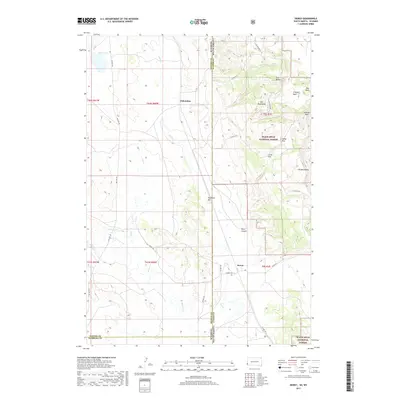
2017 Map of Dewey
USGS Topo · Published 2017About this map
Dakoming and Dewey sit along the border of Wyoming and South Dakota, where the high plains meet the western reaches of the Black Hills National Forest. This landscape is defined by its transition from the open drainage of Beaver Cr and Hay Cr in the west to the higher elevations of the Elk Mountains and Sullivan Peak to the east. The map captures a sparsely populated frontier region where the grid of sections is broken only by natural landmarks like Clifton Gap and the meandering path of Old Hwy 85. Local springs such as Carr Spring and Baltzly Spring suggest the importance of water sources in this arid environment. The terrain rises significantly toward the east, reaching plateaus like the Little Flats and Holey Flat, providing a detailed look at the topographic character of Weston and Custer Counties.
Find a feature on this map
35 named features on this map. Tap any name to fly to it.
Don’t see what you’re looking for? This feature index may not catch every label — zoom into the map to look around manually.
Map Details
Editions of this 2017 Dewey Map
This is the sole edition of this map. No revisions or reprints were ever made.
Other maps of this area

1896 · Harney Peak
USGS Topo · 1:125,000

1899 · Newcastle
USGS Topo · 1:125,000

1901 · Harney Peak
USGS Topo · 1:125,000

1901 · Newcastle
USGS Topo · 1:125,000

1902 · Edgemont
USGS Topo · 1:125,000

1950 · Burdock
USGS Topo · 1:24,000

1951 · Owens
USGS Topo · 1:24,000

1951 · Dewey
USGS Topo · 1:24,000

1951 · Dewey SW
USGS Topo · 1:24,000

1951 · Twentyone Divide
USGS Topo · 1:24,000