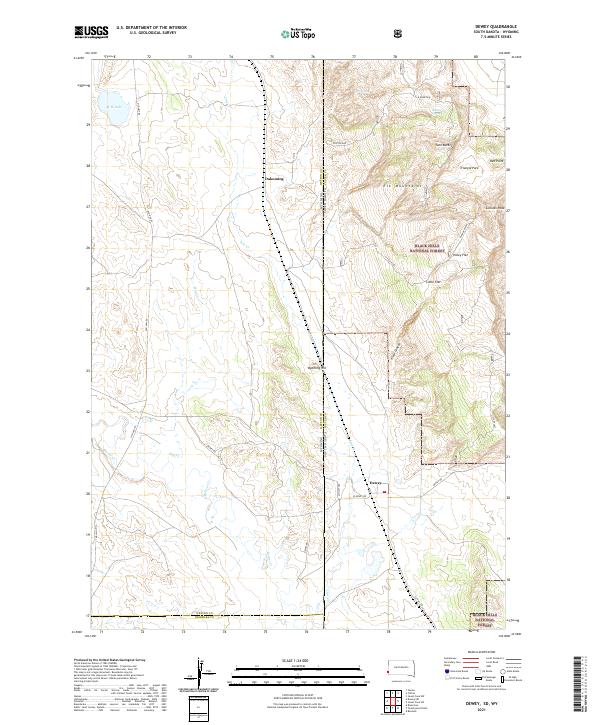
2021 Map of Dewey
USGS Topo · Published 2021About this map
Dewey sits at a critical junction of transport and topography along the border of South Dakota and Wyoming. This 2021 survey illustrates a landscape defined by the western edge of the Black Hills National Forest, where the terrain rises sharply from the plains toward landmarks such as Elk Mountain and Sullivan Peak. The settlement of Dakoming and the lookout point at Wyoming Hill are situated near the state line, reflecting the area's historical role as a transit corridor. Water remains a vital feature in this arid environment, with Carr Spring and Baltzly Spring feeding into drainages like Beaver Cr and Line Cr. The presence of Old Hwy 85 and Dewey Rd underscores the persistent infrastructure connecting these isolated ranching and forest-border communities.
Find a feature on this map
33 named features on this map. Tap any name to fly to it.
Don’t see what you’re looking for? This feature index may not catch every label — zoom into the map to look around manually.
Map Details
Editions of this 2021 Dewey Map
This is the sole edition of this map. No revisions or reprints were ever made.
Other maps of this area

1896 · Harney Peak
USGS Topo · 1:125,000

1899 · Newcastle
USGS Topo · 1:125,000

1901 · Harney Peak
USGS Topo · 1:125,000

1901 · Newcastle
USGS Topo · 1:125,000

1902 · Edgemont
USGS Topo · 1:125,000

1950 · Burdock
USGS Topo · 1:24,000

1951 · Owens
USGS Topo · 1:24,000

1951 · Dewey
USGS Topo · 1:24,000

1951 · Dewey SW
USGS Topo · 1:24,000

1951 · Twentyone Divide
USGS Topo · 1:24,000