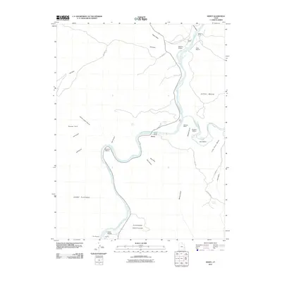
2010 Map of Dewey
USGS Topo · Published 2010About this map
The Colorado River carves a deep path through Grand County, serving as the central artery for this remote high-desert landscape. Near the confluence with the Dolores River, the river creates distinctive alluvial flats such as Hittle Bottom, Ninemile Bottom, and Roberts Bottom. The settlement at Dewey and the nearby Dewey Bridge mark a critical crossing point in a region dominated by sheer topographical barriers like the Richardson Amphitheater and Hotel Mesa. Local land use is characterized by isolated outposts like Gordon Ranch and Cato Ranch, which occupy the few accessible areas between the steep walls of Yellow Jacket Canyon and Waring Canyon. The presence of Gold Mine Rd and various natural springs, including Buck Spring, indicates a long history of resource seeking and ranching in the Professor Valley area.
Find a feature on this map
37 named features on this map. Tap any name to fly to it.
Don’t see what you’re looking for? This feature index may not catch every label — zoom into the map to look around manually.
Map Details
Editions of this 2010 Dewey Map
This is the sole edition of this map. No revisions or reprints were ever made.
Other maps of this area

1885 · La Sal
USGS Topo · 1:250,000

1954 · Mt. Waas 4 NW
USGS Topo · 1:24,000

1954 · Mt. Waas 3 NE
USGS Topo · 1:24,000

1954 · Mt. Waas 1 SW
USGS Topo · 1:24,000

1954 · Mt. Waas 3 NW
USGS Topo · 1:24,000

1954 · Mt. Waas 1 NW
USGS Topo · 1:24,000

1954 · Coates Creek
USGS Topo · 1:62,500

1954 · Polar Mesa
USGS Topo · 1:62,500

1954 · Castle Valley
USGS Topo · 1:62,500

1955 · Mt. Waas 2 SE
USGS Topo · 1:24,000