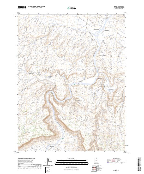
2023 Map of Dewey
USGS Topo · Published 2023About this map
The Colorado River carves a massive winding path through this corner of Grand County, Utah, defining the dramatic topography from McGraw Bottom in the north to the Professor Valley in the south. The landscape is characterized by its high mesas and deep-cut canyons, including the Mule Shoe bend and the expansive Richardson Amphitheater. Human presence is marked by a network of back-country roads such as Gold Mine Rd and Old Shari Ranch Rd, which navigate the plateaus and connect various river bottoms.
Find a feature on this map
39 named features on this map. Tap any name to fly to it.
Don’t see what you’re looking for? This feature index may not catch every label — zoom into the map to look around manually.
Map Details
Editions of this 2023 Dewey Map
This is the sole edition of this map. No revisions or reprints were ever made.
Other maps of this area

1885 · La Sal
USGS Topo · 1:250,000

1954 · Mt. Waas 4 NW
USGS Topo · 1:24,000

1954 · Mt. Waas 3 NE
USGS Topo · 1:24,000

1954 · Mt. Waas 1 SW
USGS Topo · 1:24,000

1954 · Mt. Waas 3 NW
USGS Topo · 1:24,000

1954 · Mt. Waas 1 NW
USGS Topo · 1:24,000

1954 · Coates Creek
USGS Topo · 1:62,500

1954 · Polar Mesa
USGS Topo · 1:62,500

1954 · Castle Valley
USGS Topo · 1:62,500

1955 · Mt. Waas 2 SE
USGS Topo · 1:24,000