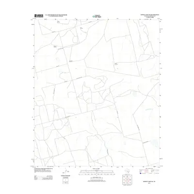
2012 Map of Dewey Lake NE
USGS Topo · Published 2012About this map
The arid ranching country of Glasscock County is defined here by its essential water infrastructure and a network of named county and private roads. Named landmarks across the landscape include the Sand Windmill, Shell Windmill, and Salt Lake Windmill, which reflect the historical importance of localized water sources in the West Texas plains. The terrain is sparsely settled, characterized by large parcels accessible via routes such as Hillger Rd and Co Rd 430. In the eastern portion of the map, the ephemeral drainage of the W Fork Apple Cr cuts through the landscape, providing a natural contrast to the geometric grid of private ranch roads. This detailed survey by the U.S. Geological Survey captures the functional geography of the region, from the Crows Nest Windmill in the northwest to the South Windmill, illustrating the enduring patterns of land use and resource management in this part of Texas.
Find a feature on this map
17 named features on this map. Tap any name to fly to it.
Don’t see what you’re looking for? This feature index may not catch every label — zoom into the map to look around manually.
Map Details
Editions of this 2012 Dewey Lake NE Map
This is the sole edition of this map. No revisions or reprints were ever made.
Other maps of this area

1941 · Morita
USGS Topo · 1:62,500

1941 · Big Spring South
USGS Topo · 1:62,500

1942 · Big Spring South
USGS Topo · 1:62,500

1949 · Morita
USGS Topo · 1:62,500

1954 · Big Spring
USGS Topo · 1:250,000

1954 · San Angelo
USGS Topo · 1:250,000

1958 · San Angelo
USGS Topo · 1:250,000

1958 · Big Spring
USGS Topo · 1:250,000

1963 · Ballinger Ranch
USGS Topo · 1:24,000

1963 · Garden City
USGS Topo · 1:24,000