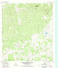
1962 Map of Dewville
USGS Topo · Published 1987About this map
Capote Hills and the prominent Capote Knob rise above the intersection of Guadalupe, Gonzales, and Wilson counties, defining a landscape of ranching and early petroleum exploration. This 1962 survey, updated with purple revisions in the 1980s, documents the rural settlement of Dewville at the southern edge of the sheet. The area is heavily defined by its drainage network, including Sandies Creek, Tidwell Creek, and O'Neal Creek, which cut through the terrain alongside named hollows. Genealogical markers are found at the Dewville Cem and Sandy Chapel Cem, while the local economy is evidenced by scattered Oil Wells, a Landing Strip, and established holdings like Escondido Ranch and Quien Sabe Ranch. The presence of several flowing wells and a network of jeep trails suggests a remote landscape that remained focused on livestock and land management throughout the mid-20th century.
Find a feature on this map
23 named features on this map. Tap any name to fly to it.
Don’t see what you’re looking for? This feature index may not catch every label — zoom into the map to look around manually.
Map Details
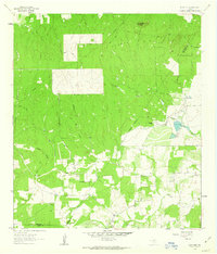
Editions of this 1962 Dewville Map
2 editions found
Other maps of this area

1911 · San Marcos
USGS Topo · 1:125,000

1919 · San Marcos
USGS Topo · 1:125,000

1920 · Smiley
USGS Topo · 1:125,000

1924 · San Marcos 3-c
USGS Topo · 1:48,000

1924 · San Marcos 3-d
USGS Topo · 1:48,000

1925 · San Marcos 4-c
USGS Topo · 1:48,000

1929 · Luling
USGS Topo · 1:62,500

1930 · Seguin
USGS Topo · 1:62,500

1942 · Dewville
USGS Topo · 1:62,500

1953 · Seguin
USGS Topo · 1:250,000