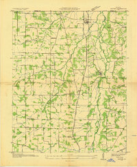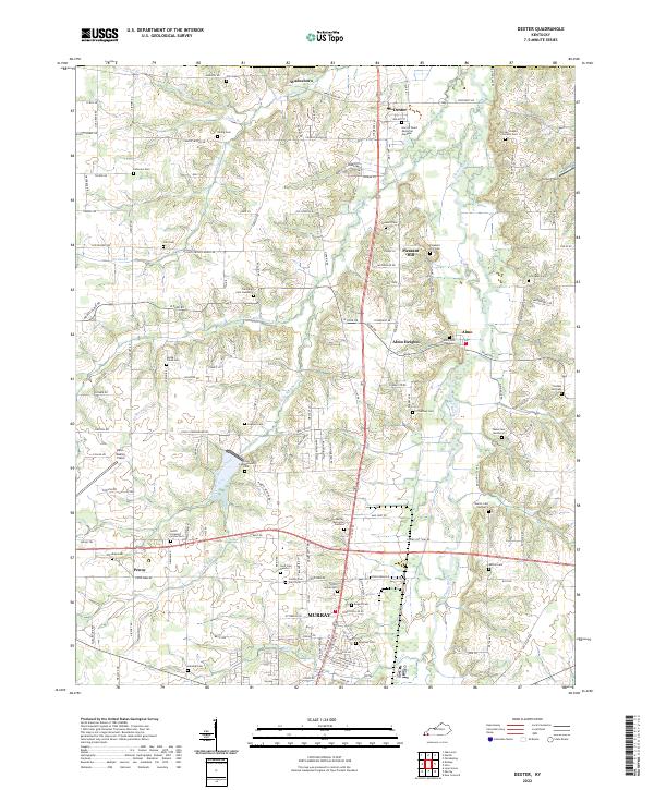
1969 Map of Dexter
USGS Topo · Published 1970About this map
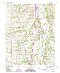
The Louisville and Nashville railroad serves as the central spine of this Calloway County landscape, connecting the small agrarian hubs of Dexter, Almo, and Almo Heights. This 1969 survey reveals a rural society structured around its community institutions, with numerous country churches such as Wadesboro Ch, Flint Ch, and Owen Chapel marking the intersections of an extensive secondary road network. The landscape is defined by the winding course of the Clarks River and the West Fork Clarks River, which create a complex drainage pattern of creeks like Spring Creek and Miller Branch.
Find a feature on this map
52 named features on this map. Tap any name to fly to it.
Don’t see what you’re looking for? This feature index may not catch every label — zoom into the map to look around manually.
Map Details
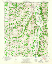
Editions of this 1969 Dexter Map
2 editions found
Historical Maps of Murray Through Time
8 maps found