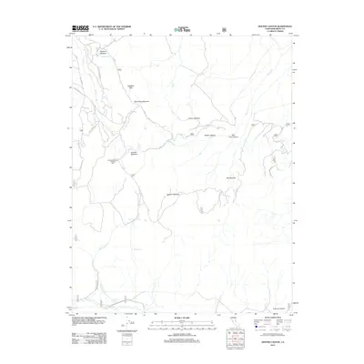
2012 Map of Dexter Canyon
USGS Topo · Published 2012About this map
Sagehen Peak and the high-elevation basin of the eastern Sierra Nevada define this corner of Mono County as it was documented in 2012. The landscape is characterized by a high concentration of seasonally watered grasslands, including Sagehen Meadow, Wild Horse Meadow, and Johnny Meadow, which provided essential resources for grazing and transit. The presence of the Crooked Meadows Camping Area signals the region's transition into a recreational destination within the national forest system. The drainage patterns of Dexter Cr and McLaughlin Cr feed south toward the Owens River, illustrating the complex hydrology of this arid but spring-fed mountain environment. These reliable water sources, such as McLaughlin Springs and Ford Spring, historically dictated the movement of livestock and travelers through Dexter Canyon and across the Ridge Cutoff.
Find a feature on this map
24 named features on this map. Tap any name to fly to it.
Don’t see what you’re looking for? This feature index may not catch every label — zoom into the map to look around manually.
Map Details
Editions of this 2012 Dexter Canyon Map
This is the sole edition of this map. No revisions or reprints were ever made.
Other maps of this area

1914 · Mt. Morrison
USGS Topo · 1:125,000

1947 · Mariposa
USGS Topo · 1:250,000

1948 · Mariposa
USGS Topo · 1:250,000

1953 · Mt. Morrison
USGS Topo · 1:62,500

1953 · Casa Diablo Mtn
USGS Topo · 1:62,500

1957 · Mariposa
USGS Topo · 1:250,000

1962 · Cowtrack Mtn
USGS Topo · 1:62,500

1962 · Glass Mountain
USGS Topo · 1:62,500

1963 · Mariposa
USGS Topo · 1:250,000
1983 · Whitmore Hot Sprs
USGS Topo · 1:24,000