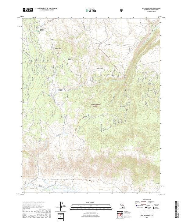
2021 Map of Dexter Canyon
USGS Topo · Published 2021About this map
Sagehen Peak towers over a landscape of high-altitude meadows and canyon systems within the Inyo National Forest. This 2021 survey of the Eastern Sierra region illustrates a complex network of forest trails and primitive roads, including the 28e103 Trl and Bakers Road. The area is defined by its seasonal water sources, featuring numerous named springs such as Sagehen Spring and McLaughlin Springs, which feed into the drainage basins of Dexter Cr and McLaughlin Cr. The map's detail reveals the importance of meadow ecosystems in this environment, from the broad Wild Horse Meadow to the aptly named Wet Meadow. Historic cattle or sheep grazing patterns are implied by the abundance of named meadows like Johnny Meadow and Crooked Meadows that dot the high country, providing essential grazing and water in an otherwise arid mountain corridor.
Find a feature on this map
45 named features on this map. Tap any name to fly to it.
Don’t see what you’re looking for? This feature index may not catch every label — zoom into the map to look around manually.
Map Details
Editions of this 2021 Dexter Canyon Map
This is the sole edition of this map. No revisions or reprints were ever made.
Other maps of this area

1914 · Mt. Morrison
USGS Topo · 1:125,000

1947 · Mariposa
USGS Topo · 1:250,000

1948 · Mariposa
USGS Topo · 1:250,000

1953 · Mt. Morrison
USGS Topo · 1:62,500

1953 · Casa Diablo Mtn
USGS Topo · 1:62,500

1957 · Mariposa
USGS Topo · 1:250,000

1962 · Cowtrack Mtn
USGS Topo · 1:62,500

1962 · Glass Mountain
USGS Topo · 1:62,500

1963 · Mariposa
USGS Topo · 1:250,000
1983 · Whitmore Hot Sprs
USGS Topo · 1:24,000