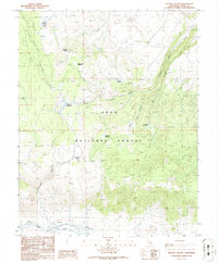
1986 Map of Dexter Canyon
USGS Topo · Published 1986About this map
High-altitude meadows and drainage systems define this mid-1980s landscape within the Inyo National Forest. The map detail follows the descent from peaks like Sagehen Peak toward the expansive floor of Long Valley in the south. This terrain is characterized by a high density of water sources essential for high-country life, ranging from the prominent Owens River and Dexter Creek to smaller, isolated points like Ford Spring and Pilot Spring.
Find a feature on this map
22 named features on this map. Tap any name to fly to it.
Don’t see what you’re looking for? This feature index may not catch every label — zoom into the map to look around manually.
Map Details
Editions of this 1986 Dexter Canyon Map
This is the sole edition of this map. No revisions or reprints were ever made.
Other maps of this area

1914 · Mt. Morrison
USGS Topo · 1:125,000

1947 · Mariposa
USGS Topo · 1:250,000

1948 · Mariposa
USGS Topo · 1:250,000

1953 · Mt. Morrison
USGS Topo · 1:62,500

1953 · Casa Diablo Mtn
USGS Topo · 1:62,500

1957 · Mariposa
USGS Topo · 1:250,000

1962 · Cowtrack Mtn
USGS Topo · 1:62,500

1962 · Glass Mountain
USGS Topo · 1:62,500

1963 · Mariposa
USGS Topo · 1:250,000
1983 · Whitmore Hot Sprs
USGS Topo · 1:24,000