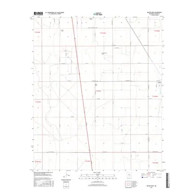
2017 Map of Dexter West
USGS Topo · Published 2017About this map
Hagerman Canal defines the eastern edge of this landscape near the town of Dexter, where irrigation infrastructure meets the arid Pecos Valley terrain. The map documents a blend of ranching history and modern institutional land use, anchored by the Roswell Correctional Center and aviation facilities like Benedict Airpark and Jenkins Airport. Local nomenclature preserves the region's heritage through roads such as Old Chisum Trl, reflecting the legacy of the historic Chisum cattle trails. Seasonal drainage patterns are visible through Thirteenmile Draw and Zubi Draw, which cut across a grid of section lines and county roads including E Shawnee Rd and Cherokee Rd. This 2017 survey provides a detailed look at the rural-suburban interface of Chaves County, showing how water management and transportation networks have shaped settlement patterns outside the municipal limits.
Find a feature on this map
53 named features on this map. Tap any name to fly to it.
Don’t see what you’re looking for? This feature index may not catch every label — zoom into the map to look around manually.
Map Details
Editions of this 2017 Dexter West Map
This is the sole edition of this map. No revisions or reprints were ever made.
Other maps of this area

1949 · Peters Lake
USGS Topo · 1:24,000

1949 · Roswell South
USGS Topo · 1:24,000

1950 · Dexter West
USGS Topo · 1:24,000

1950 · Bottomless Lakes
USGS Topo · 1:24,000

1950 · South Spring
USGS Topo · 1:24,000

1950 · Dexter East
USGS Topo · 1:24,000

1951 · Hagerman
USGS Topo · 1:24,000

1952 · Hagerman SW
USGS Topo · 1:24,000

1955 · Hackberry Ranch
USGS Topo · 1:24,000

1955 · Roswell
USGS Topo · 1:250,000