
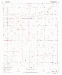
1952 Map of Hagerman SW
USGS Topo · Published 1954About this map
Rio Felix winds eastward across this high desert landscape, cutting a natural path through an area defined by early 20th-century ranching and irrigation. The map reveals the critical role of water management in Chaves County, showing the extensive Hagerman Canal and various Ditch systems designed to sustain agricultural efforts in this arid region. The presence of Hurst Ranch and Hill Ranch speaks to the established grazing operations of the early 1950s, while the Lake Arthur Cemetery and multiple Windmill sites provide valuable reference points for genealogists tracing local history in the Chaves County area.
Find a feature on this map
11 named features on this map. Tap any name to fly to it.
Don’t see what you’re looking for? This feature index may not catch every label — zoom into the map to look around manually.
Map Details
Editions of this 1952 Hagerman SW Map
2 editions found
Other maps of this area

1949 · Peters Lake
USGS Topo · 1:24,000

1950 · Dexter West
USGS Topo · 1:24,000

1950 · Dexter East
USGS Topo · 1:24,000

1951 · Hagerman
USGS Topo · 1:24,000

1953 · Espuela
USGS Topo · 1:24,000

1954 · Carlsbad
USGS Topo · 1:250,000

1955 · Artesia NE
USGS Topo · 1:24,000

1955 · Hackberry Ranch
USGS Topo · 1:24,000

1955 · Hope NE
USGS Topo · 1:24,000

1955 · Roswell
USGS Topo · 1:250,000