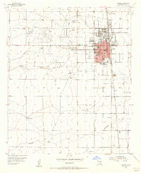
1955 Map of Hope NE
USGS Topo · Published 1956About this map
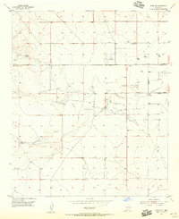
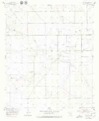
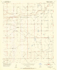
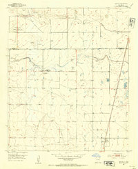
Nelson Landing Field stands as a distinct landmark on the landscape of the high plains north of Hope during the mid-1950s. The terrain is defined by the winding course of Cottonwood Creek and a network of water management features, including a prominent Ditch system and a natural Spring. This area along the Chaves and Eddy County line shows an environment adapted for ranching and limited industry, as evidenced by a Gravel Pit and numerous wells dotting the range. The presence of the Childress Recorder Well indicates the importance of groundwater monitoring in this arid Pecos Valley region. The map provides an intricate view of the local drainage patterns and human infrastructure, such as various windmills and unnamed private roads that supported the local ranching economy at the time of the 1955 survey.
Find a feature on this map
8 named features on this map. Tap any name to fly to it.
Don’t see what you’re looking for? This feature index may not catch every label — zoom into the map to look around manually.
Map Details
Editions of this 1955 Hope NE Map
2 editions found
Other maps of this area
1952 · Hagerman SW
USGS Topo · 1:24,000
1953 · Espuela
USGS Topo · 1:24,000

1954 · Carlsbad
USGS Topo · 1:250,000
1955 · Artesia
USGS Topo · 1:24,000

1955 · Hope NW
USGS Topo · 1:24,000

1955 · Hackberry Ranch
USGS Topo · 1:24,000

1955 · Kincaid Ranch
USGS Topo · 1:24,000
1955 · Hope
USGS Topo · 1:24,000

1955 · Roswell
USGS Topo · 1:250,000
1956 · Hope
USGS Topo · 1:24,000