
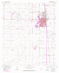
1955 Map of Artesia
USGS Topo · Published 1955About this map
Artesia serves as a mid-century hub of industry and infrastructure, defined by the Atchison Topeka and Santa Fe railroad corridor and a significant oil Refinery presence on the city's eastern edge. The map captures a transition from urban blocks to the sprawling western ranch lands, anchored by the McKinstry Ranch. A unique historical marker is the Prisoner of War Camp located north of the city center, a remnant of the region's role during World War II.
Find a feature on this map
35 named features on this map. Tap any name to fly to it.
Don’t see what you’re looking for? This feature index may not catch every label — zoom into the map to look around manually.
Map Details
Editions of this 1955 Artesia Map
2 editions found
Other maps of this area

1953 · Espuela
USGS Topo · 1:24,000

1954 · Carlsbad
USGS Topo · 1:250,000

1955 · Artesia NE
USGS Topo · 1:24,000

1955 · Spring Lake
USGS Topo · 1:24,000

1955 · Dayton
USGS Topo · 1:24,000

1955 · Lake Mc Millan North
USGS Topo · 1:24,000

1955 · Hope NE
USGS Topo · 1:24,000

1956 · Parish Ranch
USGS Topo · 1:24,000

1956 · Hope SE
USGS Topo · 1:24,000

1958 · Carlsbad
USGS Topo · 1:250,000