
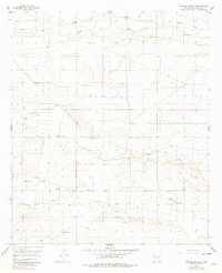
1956 Map of Parish Ranch
USGS Topo · Published 1957About this map
Rio Peñasco flows across the northern reaches of this mid-century ranching landscape, a region defined by scattered water sources and isolated homesteads. The terrain is marked by seasonal drainages such as Fourmile Draw and Red Tank Draw, which converge toward the North Seven Rivers in the southeast. Ranching operations are the primary footprint on the land, evidenced by several named property headquarters and vital water infrastructure. Settlements like Gardner and Siecrest are situated alongside private holdings such as Coffin Ranch and the namesake Parish Ranch. The reliance on groundwater in this arid Eddy County environment is clear from the distribution of named sites like Arnold Well, Neds Well, and Stallin Well, which provided the necessary resources for livestock and survival in the high desert of the 1950s.
Find a feature on this map
12 named features on this map. Tap any name to fly to it.
Don’t see what you’re looking for? This feature index may not catch every label — zoom into the map to look around manually.
Map Details
Editions of this 1956 Parish Ranch Map
2 editions found
Other maps of this area

1954 · Seven Rivers
USGS Topo · 1:24,000

1954 · Carlsbad
USGS Topo · 1:250,000

1955 · Artesia
USGS Topo · 1:24,000

1955 · Dayton
USGS Topo · 1:24,000

1955 · Hope
USGS Topo · 1:24,000

1956 · Hope
USGS Topo · 1:24,000

1956 · Antelope Sink
USGS Topo · 1:24,000

1956 · Hope SE
USGS Topo · 1:24,000

1957 · Foster Ranch
USGS Topo · 1:24,000

1957 · Box Canyon Ranch
USGS Topo · 1:24,000