
1956 Map of Antelope Sink
USGS Topo · Published 1957About this map
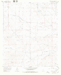
The arid ranching landscape of Antelope Sink is defined by an intricate network of seasonal drainage and water management features captured during a 1956 planetable survey. The terrain is marked by numerous family-named landmarks including Runyan Ranch and Bunting Ranch, along with scattered infrastructure essential for desert life, such as Hilt Well and Williams Well. The northern edge of the sheet is dominated by the Rio Penasco and the Walnut Draw confluence, while further south, the land is etched by the long courses of Fourmile Draw and Gardner Draw.
Find a feature on this map
18 named features on this map. Tap any name to fly to it.
Don’t see what you’re looking for? This feature index may not catch every label — zoom into the map to look around manually.
Map Details
Editions of this 1956 Antelope Sink Map
2 editions found
Other maps of this area

1954 · Carlsbad
USGS Topo · 1:250,000

1955 · Hope
USGS Topo · 1:24,000

1956 · Hope
USGS Topo · 1:24,000

1956 · Parish Ranch
USGS Topo · 1:24,000

1956 · Hope SE
USGS Topo · 1:24,000

1957 · Foster Ranch
USGS Topo · 1:24,000

1957 · Box Canyon Ranch
USGS Topo · 1:24,000

1958 · Carlsbad
USGS Topo · 1:250,000

1960 · Teel Ranch
USGS Topo · 1:62,500

1978 · Strychnine Draw
USGS Topo · 1:24,000