
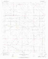
1956 Map of Hope SE
USGS Topo · Published 1957About this map
Eaton Ranch and Laney Ranch anchor the arid landscape of Eddy County in the mid-1950s, a region defined by the critical search for water and the remnants of early transportation. This survey reveals a transition from rail to air, dominated by an Old Railroad Grade and the Emergency Landing Field (Aban'd) in the northeastern corner. The importance of groundwater in this high desert environment is evident through a network of named water sources, including the Section Six Well, Willar Well, and Laney Well. Erosion patterns from Eagle Draw and Catclaw Draw cut through the terrain, while numerous segments of Abandoned Ditch suggest shifts in irrigation or cattle ranching practices. Local history is further preserved at the Old Horner Place, marking an earlier era of settlement in this remote corner of New Mexico.
Find a feature on this map
18 named features on this map. Tap any name to fly to it.
Don’t see what you’re looking for? This feature index may not catch every label — zoom into the map to look around manually.
Map Details
Editions of this 1956 Hope SE Map
2 editions found
Other maps of this area

1953 · Espuela
USGS Topo · 1:24,000

1954 · Carlsbad
USGS Topo · 1:250,000

1955 · Artesia
USGS Topo · 1:24,000

1955 · Hope NW
USGS Topo · 1:24,000

1955 · Dayton
USGS Topo · 1:24,000

1955 · Hope NE
USGS Topo · 1:24,000

1955 · Hope
USGS Topo · 1:24,000

1956 · Hope
USGS Topo · 1:24,000

1956 · Parish Ranch
USGS Topo · 1:24,000

1956 · Antelope Sink
USGS Topo · 1:24,000