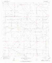
1956 Map of Hope SE
USGS Topo · Published 1957About this map
The high plains of southeast New Mexico are defined here by a network of ranching homesteads and intermittent watercourses during the mid-1950s. Established landmarks like Eaton Ranch, Laney Ranch, and the Old Horner Place reveal the sparse but persistent settlement pattern of the Chihuahuan Desert landscape. The influence of early 20th-century infrastructure is visible in the decommissioned Old Railroad Grade and an Emergency Landing Field (Aband), reflecting the region's evolving transportation and aviation history. Water management, critical for livestock and survival in this arid environment, is meticulously documented through numerous named sources including the Eaton Well, Laney Well, and Section Six Well. These features, along with drainage paths like Eagle Draw and Catclaw Draw, provide essential context for researchers tracing land use and family history in this corner of Eddy County.
Find a feature on this map
15 named features on this map. Tap any name to fly to it.
Don’t see what you’re looking for? This feature index may not catch every label — zoom into the map to look around manually.
Map Details
Editions of this 1956 Hope SE Map
2 editions found

Other maps of this area

1953 · Espuela
USGS Topo · 1:24,000

1954 · Carlsbad
USGS Topo · 1:250,000

1955 · Artesia
USGS Topo · 1:24,000

1955 · Hope NW
USGS Topo · 1:24,000

1955 · Dayton
USGS Topo · 1:24,000

1955 · Hope NE
USGS Topo · 1:24,000

1955 · Hope
USGS Topo · 1:24,000

1956 · Hope
USGS Topo · 1:24,000

1956 · Parish Ranch
USGS Topo · 1:24,000

1956 · Antelope Sink
USGS Topo · 1:24,000