
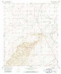
1954 Map of Seven Rivers
USGS Topo · Published 1956About this map
The Seven Rivers settlement and its surrounding hydraulic landscape are the focus of this mid-century survey in Eddy County. Situated where the Middle Seven Rivers, South Seven Rivers, and North Seven Rivers converge before joining the Pecos River, the area is defined by its complex water network. Significant natural springs like Bubbling Spring, Roaring Spring, and Major Johnson Springs provide vital water sources in this arid environment, while the prominent Seven Hills rise to the south. The map documents the layout of the region during the 1950s, showing the precise location of the Seven Rivers Cemetery and a local Landing Field, illustrating the transition from early ranching roots to modern infrastructure. Water management is further evidenced by Willow Draw and Rocky Arroyo, which carve through the high ground toward the river valley.
Find a feature on this map
15 named features on this map. Tap any name to fly to it.
Don’t see what you’re looking for? This feature index may not catch every label — zoom into the map to look around manually.
Map Details
Editions of this 1954 Seven Rivers Map
2 editions found
Other maps of this area

1940 · Bandanna Point
USGS Topo · 1:62,500

1943 · Bandanna Point
USGS Topo · 1:62,500

1943 · West Carlsbad
USGS Topo · 1:62,500

1945 · West Carlsbad
USGS Topo · 1:62,500

1954 · Carlsbad
USGS Topo · 1:250,000

1955 · Dayton
USGS Topo · 1:24,000

1955 · Lake Mc Millan North
USGS Topo · 1:24,000

1955 · Lake Mc Millan South
USGS Topo · 1:24,000

1956 · Parish Ranch
USGS Topo · 1:24,000

1957 · Foster Ranch
USGS Topo · 1:24,000