
1955 Map of Lake Mc Millan South
USGS Topo · Published 1956About this map
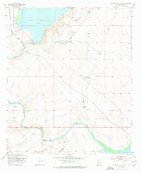
Lake Mc Millan dominates the northern reaches of this mid-1950s survey of Eddy County, serving as a vital reservoir for the surrounding arid landscape. The Pecos River snakes southward from the lake, carving a path through terrain defined by numerous dry washes such as Dagger Draw and Soapberry Draw. This era shows a landscape where water management and industrial development intersect, evidenced by the cluster of Oil Wells (Active) and an associated Oil Tank located just east of the river's main channel.
Find a feature on this map
15 named features on this map. Tap any name to fly to it.
Don’t see what you’re looking for? This feature index may not catch every label — zoom into the map to look around manually.
Map Details
Editions of this 1955 Lake Mc Millan South Map
2 editions found
Other maps of this area

1939 · Carlsbad
USGS Topo · 1:62,500

1943 · Carlsbad
USGS Topo · 1:62,500

1943 · Oil City
USGS Topo · 1:62,500

1943 · West Carlsbad
USGS Topo · 1:62,500

1945 · West Carlsbad
USGS Topo · 1:62,500

1954 · Seven Rivers
USGS Topo · 1:24,000

1954 · Carlsbad
USGS Topo · 1:250,000

1955 · Dayton
USGS Topo · 1:24,000

1955 · Lake Mc Millan North
USGS Topo · 1:24,000

1958 · Carlsbad
USGS Topo · 1:250,000