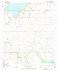
1955 Map of Lake Mc Millan South
USGS Topo · Published 1977About this map
The Pecos River valley in the mid-1950s is defined by its vital water infrastructure and the steady rhythm of ranching and early petroleum extraction. To the north, Lake Mc Millan is contained by a significant Levee, feeding water downriver toward Lake Avalon at the southern edge of the survey. The Atchison Topeka and Santa Fe railroad snakes along the river's western bank, providing a critical transport link for this arid landscape.
Find a feature on this map
15 named features on this map. Tap any name to fly to it.
Don’t see what you’re looking for? This feature index may not catch every label — zoom into the map to look around manually.
Map Details
Editions of this 1955 Lake Mc Millan South Map
2 editions found
Other maps of this area

1939 · Carlsbad
USGS Topo · 1:62,500

1943 · Carlsbad
USGS Topo · 1:62,500

1943 · Oil City
USGS Topo · 1:62,500

1943 · West Carlsbad
USGS Topo · 1:62,500

1945 · West Carlsbad
USGS Topo · 1:62,500

1954 · Seven Rivers
USGS Topo · 1:24,000

1954 · Carlsbad
USGS Topo · 1:250,000

1955 · Dayton
USGS Topo · 1:24,000

1955 · Lake Mc Millan North
USGS Topo · 1:24,000

1955 · Lake Mc Millan South
USGS Topo · 1:24,000