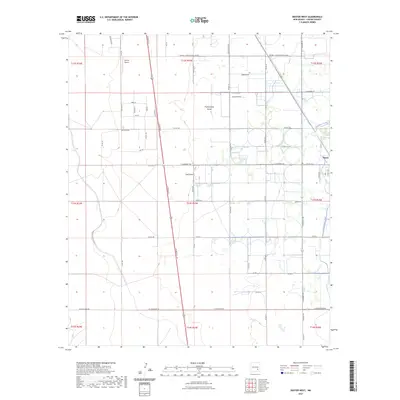
2023 Map of Dexter West
USGS Topo · Published 2023About this map
Hagerman Canal defines the eastern agricultural corridor of this Chaves County landscape, where irrigation infrastructure supports the rural outskirts of Dexter. The terrain is characterized by broad ephemeral watercourses like Thirteenmile Draw and Zubi Draw, which cut across a grid of section lines and county roads. Transportation is anchored by the north-south axis of SE Main St, running parallel to the historic route of the Old Chisum Trl, a name reflecting the region's deep ranching heritage. Near the northern boundary, Jenkins Airport and the Roswell Correctional Center stand as significant modern landmarks. The map meticulously records numerous local thoroughfares including Cherokee Rd and Caddo Rd, illustrating the intersection of state-managed facilities and the enduring rural settlement patterns of the Pecos Valley.
Find a feature on this map
55 named features on this map. Tap any name to fly to it.
Don’t see what you’re looking for? This feature index may not catch every label — zoom into the map to look around manually.
Map Details
Editions of this 2023 Dexter West Map
This is the sole edition of this map. No revisions or reprints were ever made.
Other maps of this area

1949 · Peters Lake
USGS Topo · 1:24,000

1949 · Roswell South
USGS Topo · 1:24,000

1950 · Dexter West
USGS Topo · 1:24,000

1950 · Bottomless Lakes
USGS Topo · 1:24,000

1950 · South Spring
USGS Topo · 1:24,000

1950 · Dexter East
USGS Topo · 1:24,000

1951 · Hagerman
USGS Topo · 1:24,000

1952 · Hagerman SW
USGS Topo · 1:24,000

1955 · Hackberry Ranch
USGS Topo · 1:24,000

1955 · Roswell
USGS Topo · 1:250,000