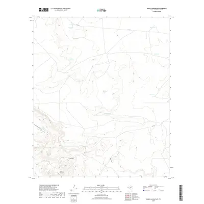
2019 Map of Diablo Canyon East
USGS Topo · Published 2019About this map
Arroyo Diablo carves through the arid landscape of western Texas, a defining drainage feature within the expansive Chihuahuan Desert. The terrain is characterized by the rugged elevations of the Finlay Mountains and the distinct channel of Gardner Draw, reflecting a classic Basin and Range topography. In this dry environment, water management is evident through a network of strategically placed catchments such as Old John Tank, West Tank, and Marr Tanks, which historically supported ranching operations in this part of Hudspeth County. Transportation in this remote sector is limited to unpaved routes like Mosley Rd and a isolated Airstrip, highlighting the area's sparse development and reliance on aviation for connectivity. Notable landmarks like Reese Lake and Flat Canyon further illustrate the diverse geological formations that define this corridor near the Mexican border.
Find a feature on this map
18 named features on this map. Tap any name to fly to it.
Don’t see what you’re looking for? This feature index may not catch every label — zoom into the map to look around manually.
Map Details
Editions of this 2019 Diablo Canyon East Map
This is the sole edition of this map. No revisions or reprints were ever made.
Other maps of this area

1894 · Fort Hancock
USGS Topo · 1:125,000

1895 · Sierra Blanca
USGS Topo · 1:125,000

1903 · Cerro Alto
USGS Topo · 1:125,000

1943 · Tepee Butte
USGS Topo · 1:62,500

1943 · Finlay Mountains
USGS Topo · 1:62,500

1948 · Triple Hill
USGS Topo · 1:62,500

1951 · Red Hills
USGS Topo · 1:62,500

1954 · Van Horn
USGS Topo · 1:250,000

1958 · Van Horn
USGS Topo · 1:250,000
1972 · Campo Grande Mountain
USGS Topo · 1:24,000