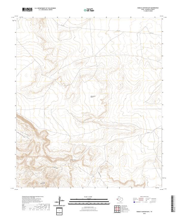
2022 Map of Diablo Canyon East
USGS Topo · Published 2022About this map
Finlay Mountains dominate the southern landscape of this Far West Texas quadrangle, where the desert floor meets the rising peaks of the Trans-Pecos. This high-altitude portion of the Chihuahuan Desert is defined by a network of drainage features like Arroyo Diablo and Gardner Draw, which reveal the erosive power of seasonal water moving through the arid environment. The map records the intersection of natural topography and utility, showing Flat Canyon and Camp Rice Arroyo alongside an isolated Airstrip, typical of the remote land-use patterns in this part of Hudspeth County. In the north, Mosley Rd provides the primary transit route through this sparse but topographically complex terrain, while the namesake Diablo Canyon cuts through the center, illustrating the basin-and-range character of the region.
Find a feature on this map
9 named features on this map. Tap any name to fly to it.
Don’t see what you’re looking for? This feature index may not catch every label — zoom into the map to look around manually.
Map Details
Editions of this 2022 Diablo Canyon East Map
This is the sole edition of this map. No revisions or reprints were ever made.
Other maps of this area

1894 · Fort Hancock
USGS Topo · 1:125,000

1895 · Sierra Blanca
USGS Topo · 1:125,000

1903 · Cerro Alto
USGS Topo · 1:125,000

1943 · Tepee Butte
USGS Topo · 1:62,500

1943 · Finlay Mountains
USGS Topo · 1:62,500

1948 · Triple Hill
USGS Topo · 1:62,500

1951 · Red Hills
USGS Topo · 1:62,500

1954 · Van Horn
USGS Topo · 1:250,000

1958 · Van Horn
USGS Topo · 1:250,000
1972 · Campo Grande Mountain
USGS Topo · 1:24,000