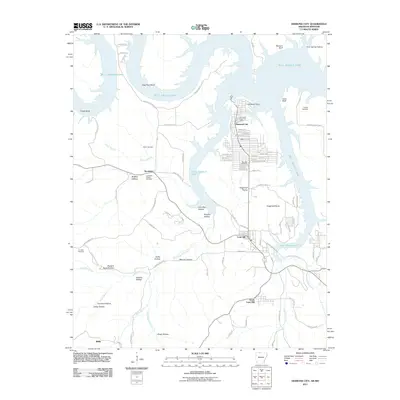
2011 Map of Diamond City
USGS Topo · Published 2011About this map
Bull Shoals Lake dominates this northern Arkansas landscape, its winding shoreline creating distinct peninsulas like Campbell Point and deep inlets near Hog Thief Bend. The modern resort community of Diamond City is mapped in detail, including the Diamond City Post Office and a residential grid bordering Fairview Cemetery. To the south, the terrain transitions into a complex of valleys and ridges, such as Sugarloaf Prairie and Terrapin Hollow, where older settlement patterns persist. Small rural communities like Lead Hill and South Lead Hill anchor the southern portion of the sheet. Genealogists can locate several burial sites throughout the rugged hills, including Pickard Cemetery on the eastern bluffs and Foresee Cemetery near Lead Mine Creek. The presence of Carrollton Hollow Cemetery near Sycamore points to the area's agricultural and homesteading roots prior to the lake's creation.
Find a feature on this map
100 named features on this map. Tap any name to fly to it.
Don’t see what you’re looking for? This feature index may not catch every label — zoom into the map to look around manually.
Map Details
Editions of this 2011 Diamond City Map
This is the sole edition of this map. No revisions or reprints were ever made.
Other maps of this area

1893 · Yellville
USGS Topo · 1:125,000

1903 · Yellville
USGS Topo · 1:125,000

1904 · Harrison
USGS Topo · 1:125,000

1905 · Harrison
USGS Topo · 1:125,000

1905 · Yellville
USGS Topo · 1:125,000

1907 · Forsyth
USGS Topo · 1:125,000

1929 · Yellville
USGS Topo · 1:125,000

1943 · Protem
USGS Topo · 1:62,500

1945 · Harrison
USGS Topo · 1:250,000

1949 · Harrison
USGS Topo · 1:250,000