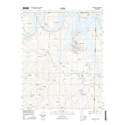
2014 Map of Diamond City
USGS Topo · Published 2014About this map
Diamond City and the neighboring communities of Lead Hill and South Lead Hill anchor the southern reaches of the massive Bull Shoals Lake reservoir along the Missouri-Arkansas border. This modern survey illustrates the complex, inundated topography of the Ozarks, where fingers of water now fill once-dry valleys like Buckley Hollow and Carrollton Hollow. The map reveals a transition from the structured residential street grids of the lakeside towns to the deeply carved terrain of the surrounding hills. Genealogists can identify several small burial sites preserved throughout the landscape, including Pickard Cem, Fairview Cem, and the Raley Cem near Sycamore. Landmarks such as Sugarloaf Knob and Willis Bald rise above a network of county roads and historic routes like Ar-14, marking the high points of a landscape defined by the interplay of the White River's dammed waters and the rugged limestone bluffs of Goat Bluff and Buzzard Bluff.
Find a feature on this map
130 named features on this map. Tap any name to fly to it.
Don’t see what you’re looking for? This feature index may not catch every label — zoom into the map to look around manually.
Map Details
Editions of this 2014 Diamond City Map
This is the sole edition of this map. No revisions or reprints were ever made.
Other maps of this area

1893 · Yellville
USGS Topo · 1:125,000

1903 · Yellville
USGS Topo · 1:125,000

1904 · Harrison
USGS Topo · 1:125,000

1905 · Harrison
USGS Topo · 1:125,000

1905 · Yellville
USGS Topo · 1:125,000

1907 · Forsyth
USGS Topo · 1:125,000

1929 · Yellville
USGS Topo · 1:125,000

1943 · Protem
USGS Topo · 1:62,500

1945 · Harrison
USGS Topo · 1:250,000

1949 · Harrison
USGS Topo · 1:250,000