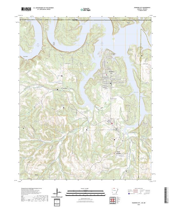
2024 Map of Diamond City
USGS Topo · Published 2024About this map
Bull Shoals Lake dominates the northern reaches of this Boone County landscape, where the Missouri Arkansas state line cuts through Hog Thief Bend and Deer Cove. The area is defined by the peninsula and shorelines of the reservoir, with the residential street grid of Diamond City and the neighboring settlements of Lead Hill and South Lead Hill situated on the higher ground south of Coffman Cove. The terrain is deeply incised by numerous hollows, including Carrollton Hollow and Terrapin Hollow, which feed into West Sugarloaf Creek.
Find a feature on this map
132 named features on this map. Tap any name to fly to it.
Don’t see what you’re looking for? This feature index may not catch every label — zoom into the map to look around manually.
Map Details
Editions of this 2024 Diamond City Map
This is the sole edition of this map. No revisions or reprints were ever made.
Other maps of this area

1893 · Yellville
USGS Topo · 1:125,000

1903 · Yellville
USGS Topo · 1:125,000

1904 · Harrison
USGS Topo · 1:125,000

1905 · Harrison
USGS Topo · 1:125,000

1905 · Yellville
USGS Topo · 1:125,000

1907 · Forsyth
USGS Topo · 1:125,000

1929 · Yellville
USGS Topo · 1:125,000

1943 · Protem
USGS Topo · 1:62,500

1945 · Harrison
USGS Topo · 1:250,000

1949 · Harrison
USGS Topo · 1:250,000