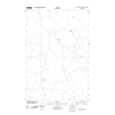
2011 Map of Diamond G Creek
USGS Topo · Published 2011About this map
Cottonwood Creek and Diamond G Creek dominate this corner of Prairie County, where the landscape is defined by the complex drainage patterns of the eastern Montana plains. The terrain is deeply inscribed by seasonal watercourses like McQuoid Coulee and Dickoff Creek, revealing a network of intermittent streams and natural draws typical of the region's semi-arid environment. Ranching infrastructure is evident through the inclusion of the Nefsy Number 4 Dam on Dry Creek and the Saucer Number 2 Dam, illustrating how water management has historically shaped local land use and livestock operations. Access through this relatively sparsely populated area is facilitated by established corridors such as Bad Route Rd and O'Neill Rd, providing essential links between isolated homesteads and the broader regional transport network.
Find a feature on this map
11 named features on this map. Tap any name to fly to it.
Don’t see what you’re looking for? This feature index may not catch every label — zoom into the map to look around manually.
Map Details
Editions of this 2011 Diamond G Creek Map
This is the sole edition of this map. No revisions or reprints were ever made.
Other maps of this area

1953 · Miles City
USGS Topo · 1:250,000

1954 · Glendive
USGS Topo · 1:250,000

1957 · Miles City
USGS Topo · 1:250,000

1957 · Glendive
USGS Topo · 1:250,000

1958 · Miles City
USGS Topo · 1:250,000

1958 · Glendive
USGS Topo · 1:250,000

1972 · Hendrickson Coulee
USGS Topo · 1:24,000

1972 · Calypso
USGS Topo · 1:24,000

1972 · Papps Reservoir
USGS Topo · 1:24,000

1972 · Diamond G Creek
USGS Topo · 1:24,000