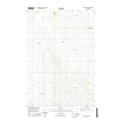
2017 Map of Diamond G Creek
USGS Topo · Published 2017About this map
Diamond G Creek flows through the heart of this Montana landscape, where the boundary between Dawson Co and Prairie Co cuts through a network of drainages and ranch roads. The terrain is defined by a complex system of watercourses including Cottonwood Cr, Brackett Cr, and the distinctive Mcquoid Coulee. Transportation across this prairie environment is anchored by Bad Route Rd and O'Neill Rd, which provide access to the remote sections of Township 14 North and Township 13 North. This 2017 survey by the U.S. Geological Survey documents the subtle but critical hydrography of the region, where ephemeral features like Dickoff Coulee and Dry Cr carve into the high plains. Researchers can trace the intersection of historical land divisions and modern infrastructure in this sparsely populated portion of eastern Montana.
Find a feature on this map
16 named features on this map. Tap any name to fly to it.
Don’t see what you’re looking for? This feature index may not catch every label — zoom into the map to look around manually.
Map Details
Editions of this 2017 Diamond G Creek Map
This is the sole edition of this map. No revisions or reprints were ever made.
Other maps of this area

1953 · Miles City
USGS Topo · 1:250,000

1954 · Glendive
USGS Topo · 1:250,000

1957 · Miles City
USGS Topo · 1:250,000

1957 · Glendive
USGS Topo · 1:250,000

1958 · Miles City
USGS Topo · 1:250,000

1958 · Glendive
USGS Topo · 1:250,000

1972 · Hendrickson Coulee
USGS Topo · 1:24,000

1972 · Calypso
USGS Topo · 1:24,000

1972 · Papps Reservoir
USGS Topo · 1:24,000

1972 · Diamond G Creek
USGS Topo · 1:24,000