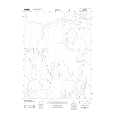
2012 Map of Diamond Mountain
USGS Topo · Published 2012About this map
The Peter Lassen Grave stands as a significant historical marker on this map, located just south of Richmond Ridge and Emerson Lake. This high-altitude terrain in Northern California is defined by the massive profile of Diamond Mountain, which anchors a landscape of high basins and seasonal water sources. The map traces a complex network of forest access routes, including the Diamond Mountain Mtwy and Pierce Creek Mtwy, which navigate the steep drainage systems of Hills Cr and Indian Cr. Land use in the early 21st century is reflected in features like the Wheeler Sheep Campground, while the presence of the Emerson Ditch indicates the ongoing management of water resources in this arid upland environment. Diverse terrain features such as Gilman Basin and Aspen Flat break the forested slopes, providing localized landmarks for those studying the geography south of the Susanville area.
Find a feature on this map
41 named features on this map. Tap any name to fly to it.
Don’t see what you’re looking for? This feature index may not catch every label — zoom into the map to look around manually.
Map Details
Editions of this 2012 Diamond Mountain Map
This is the sole edition of this map. No revisions or reprints were ever made.
Other maps of this area

1886 · Honey Lake
USGS Topo · 1:250,000

1891 · Honey Lake
USGS Topo · 1:250,000

1893 · Honey Lake
USGS Topo · 1:250,000

1950 · Kettle Rock
USGS Topo · 1:62,500

1950 · Greenville
USGS Topo · 1:62,500

1954 · Susanville
USGS Topo · 1:62,500

1955 · Westwood
USGS Topo · 1:62,500

1955 · Westwood
USGS Topo · 1:250,000

1958 · Westwood
USGS Topo · 1:250,000

1959 · Westwood
USGS Topo · 1:250,000