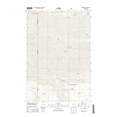
2013 Map of Diamond Peak
USGS Topo · Published 2013About this map
The Umatilla National Forest landscape across the Columbia and Garfield county line reveals a high-elevation backcountry marked by isolated camps and family holdings. At the southern edge of the quadrangle, the F Kessler Ranch, C H Neal Ranch, and J R Evans Ranch represent the high-country ranching tradition near Grouse Flat, where Kessler Mill Rd provides the primary access. Further north, the terrain transitions into a series of dramatic ridges and peaks including Mt Misery, Diamond Peak, and Halsey Butte. The map illustrates a network of essential water sources for livestock and wildlife, from Sheephead Spring near Sheephead Corral to Pistol Spring and Fairview Spring tucked along Smooth Ridge. This territory, defined by its steep drainage systems like Slide Canyon, remains largely defined by the forest service and ranching operations.
Find a feature on this map
39 named features on this map. Tap any name to fly to it.
Don’t see what you’re looking for? This feature index may not catch every label — zoom into the map to look around manually.
Map Details
Editions of this 2013 Diamond Peak Map
This is the sole edition of this map. No revisions or reprints were ever made.
Other maps of this area

1937 · Pomeroy
USGS Topo · 1:96,000

1942 · Pomeroy
USGS Topo · 1:125,000

1943 · Saddle Butte
USGS Topo · 1:62,500

1946 · Saddle Butte
USGS Topo · 1:62,500

1955 · Pullman
USGS Topo · 1:250,000

1955 · Grangeville
USGS Topo · 1:250,000

1958 · Pullman
USGS Topo · 1:250,000

1959 · Grangeville
USGS Topo · 1:250,000

1967 · Troy
USGS Topo · 1:24,000

1967 · Eden
USGS Topo · 1:24,000