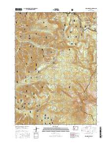
2017 Map of Diamond Peak
USGS Topo · Published 2017About this map
Diamond Peak anchors this high-elevation landscape within the Willamette National Forest and Deschutes National Forest. The 2017 survey reveals a complex network of alpine hydrology, where small, descriptively named bodies of water like Too Much Bear Lake, Notch Lake, and Happy Lake dot the basins between volcanic features. The Pacific Crest National Scenic Trail winds through the eastern portion of the quadrangle, crossing the boundary between Lane and Klamath counties near the base of Mt Yoran. This map captures the modern recreational and conservation footprint of the Oregon Cascades, showing the structural engineering of the Salt Creek Tunnel 2539 and the legacy of the Public Land Survey System through numbered land blocks like PB 47 and PB 48. Notable peaks including Hemlock Butte and Judd Mtn overlook drainage systems like Swift Cr and the S Fork Salt Cr.
Find a feature on this map
65 named features on this map. Tap any name to fly to it.
Don’t see what you’re looking for? This feature index may not catch every label — zoom into the map to look around manually.
Map Details
Editions of this 2017 Diamond Peak Map
This is the sole edition of this map. No revisions or reprints were ever made.
Other maps of this area

1917 · Diamond Lake
USGS Topo · 1:125,000

1925 · Waldo Lake
USGS Topo · 1:125,000

1956 · Toketee Falls
USGS Topo · 1:62,500

1956 · Waldo Lake
USGS Topo · 1:62,500

1956 · Summit Lake
USGS Topo · 1:62,500

1956 · Oakridge
USGS Topo · 1:62,500

1958 · Roseburg
USGS Topo · 1:250,000

1959 · Roseburg
USGS Topo · 1:250,000

1978 · Diamond Lake
USGS Topo · 1:100,000

1983 · Oakridge
USGS Topo · 1:100,000