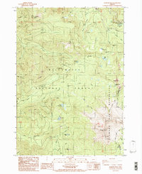
1986 Map of Diamond Peak
USGS Topo · Published 1986About this map
Diamond Peak dominates the southeastern horizon of this mid-1980s survey, marking a significant high point along the boundary shared by Lane Co and Klamath Co. The landscape is a complex network of high-elevation hydrology and volcanic topography, with the Willamette National Forest and Diamond Peak Wilderness preserving a massive inventory of mountain lakes and drainages. Notable water features include the dramatic Salt Creek Falls near the Salt Creek Campground and uniquely named bodies like Too Much Bear Lake and Happy Lake.
Find a feature on this map
39 named features on this map. Tap any name to fly to it.
Don’t see what you’re looking for? This feature index may not catch every label — zoom into the map to look around manually.
Map Details
Editions of this 1986 Diamond Peak Map
This is the sole edition of this map. No revisions or reprints were ever made.
Other maps of this area

1917 · Diamond Lake
USGS Topo · 1:125,000

1925 · Waldo Lake
USGS Topo · 1:125,000

1956 · Toketee Falls
USGS Topo · 1:62,500

1956 · Waldo Lake
USGS Topo · 1:62,500

1956 · Summit Lake
USGS Topo · 1:62,500

1956 · Oakridge
USGS Topo · 1:62,500

1958 · Roseburg
USGS Topo · 1:250,000

1959 · Roseburg
USGS Topo · 1:250,000

1978 · Diamond Lake
USGS Topo · 1:100,000

1983 · Oakridge
USGS Topo · 1:100,000