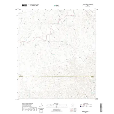
2019 Map of Diamond S Ranch
USGS Topo · Published 2019About this map
The S Fork Guadalupe River winds through the northern portion of this landscape, carving a valley overlooked by Bee Bluff. This 2019 survey documents the rugged cattle country and hunting lands straddling the border of Kerr and Bandera counties. Local water sources like Green Spring, Lynx Haven Springs, and Brewington Cr Ranch Lake indicate the critical nature of water management in this arid environment. The road network is primarily composed of private ranch access, including Fisher Ranch Rd and Auld Rd S, which connect the namesake Diamond S Ranch to surrounding holdings. This modern topographic record captures the area's transition between the higher elevations of Sycamore Draw and the various drainage basins like Mullen Cr and Honey Cr that feed into the larger river systems of the Texas Hill Country.
Find a feature on this map
33 named features on this map. Tap any name to fly to it.
Don’t see what you’re looking for? This feature index may not catch every label — zoom into the map to look around manually.
Map Details
Editions of this 2019 Diamond S Ranch Map
This is the sole edition of this map. No revisions or reprints were ever made.
Other maps of this area

1894 · Kerrville
USGS Topo · 1:125,000

1954 · Llano
USGS Topo · 1:250,000

1954 · San Antonio
USGS Topo · 1:250,000

1955 · Llano
USGS Topo · 1:250,000

1956 · Tuff
USGS Topo · 1:62,500

1956 · Llano
USGS Topo · 1:250,000

1957 · San Antonio
USGS Topo · 1:250,000

1964 · Boneyard Draw
USGS Topo · 1:24,000

1964 · Sabinal Canyon
USGS Topo · 1:24,000

1964 · Well Hollow
USGS Topo · 1:24,000