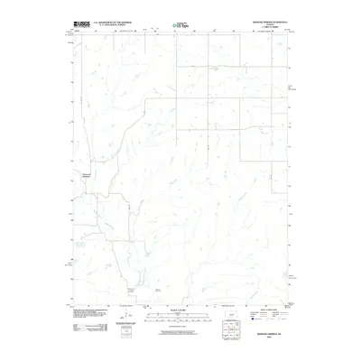
2009 Map of Diamond Springs
USGS Topo · Published 2009About this map
Diamond Springs serves as the focal point of this rural Morris County landscape, where the agricultural grid meets a complex network of waterways. The terrain is defined by the winding paths of Diamond Creek and its many tributaries, including School Creek and Silver Creek, which cut through the open country. This area represents a classic Kansas prairie settlement pattern where section roads like S 2200 RD and Z Ave provide the structure for a quiet community. Genealogists will find particular value in the documentation of local burial grounds, specifically Diamond Creek Cemetery and Boenitz Cemetery, which anchor the history of early families in the region. The map also traces smaller drainages such as Paddy Creek, Schaffer Creek, and Mulvane Creek, illustrating the natural drainage system that has dictated land use and farm placement for generations.
Find a feature on this map
17 named features on this map. Tap any name to fly to it.
Don’t see what you’re looking for? This feature index may not catch every label — zoom into the map to look around manually.
Map Details
Editions of this 2009 Diamond Springs Map
This is the sole edition of this map. No revisions or reprints were ever made.
Other maps of this area

1889 · Parkerville
USGS Topo · 1:125,000

1894 · Parkerville
USGS Topo · 1:125,000

1898 · Cottonwood Falls
USGS Topo · 1:125,000

1955 · Hutchinson
USGS Topo · 1:250,000

1957 · Strong City
USGS Topo · 1:24,000

1957 · Hymer
USGS Topo · 1:24,000

1959 · Hutchinson
USGS Topo · 1:250,000

1970 · Lincolnville NE
USGS Topo · 1:24,000
1971 · Council Grove Lake
USGS Topo · 1:24,000

1972 · Wilsey
USGS Topo · 1:24,000