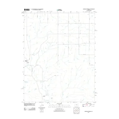
2012 Map of Diamond Springs
USGS Topo · Published 2012About this map
Diamond Springs serves as the focal point of this rural Kansas landscape, situated in an area defined by a dense network of creek drainages. The mapping reveals a distinct agricultural grid of section roads like X Ave and S 2200 Rd, which navigate around the natural meandering paths of Dodds Cr, Silver Cr, and School Cr. For those tracing local family histories, the map identifies several key burial sites including the Diamond Springs Cem, the Diamond Creek Cem, and the Boenitz Cem further east. The terrain is notably dissected by watercourses such as Diamond Cr and Schaffer Cr, illustrating how the early prairie settlement and road networks were forced to adapt to the hydrological patterns of the region.
Find a feature on this map
31 named features on this map. Tap any name to fly to it.
Don’t see what you’re looking for? This feature index may not catch every label — zoom into the map to look around manually.
Map Details
Editions of this 2012 Diamond Springs Map
This is the sole edition of this map. No revisions or reprints were ever made.
Other maps of this area

1889 · Parkerville
USGS Topo · 1:125,000

1894 · Parkerville
USGS Topo · 1:125,000

1898 · Cottonwood Falls
USGS Topo · 1:125,000

1955 · Hutchinson
USGS Topo · 1:250,000

1957 · Strong City
USGS Topo · 1:24,000

1957 · Hymer
USGS Topo · 1:24,000

1959 · Hutchinson
USGS Topo · 1:250,000

1970 · Lincolnville NE
USGS Topo · 1:24,000
1971 · Council Grove Lake
USGS Topo · 1:24,000

1972 · Wilsey
USGS Topo · 1:24,000