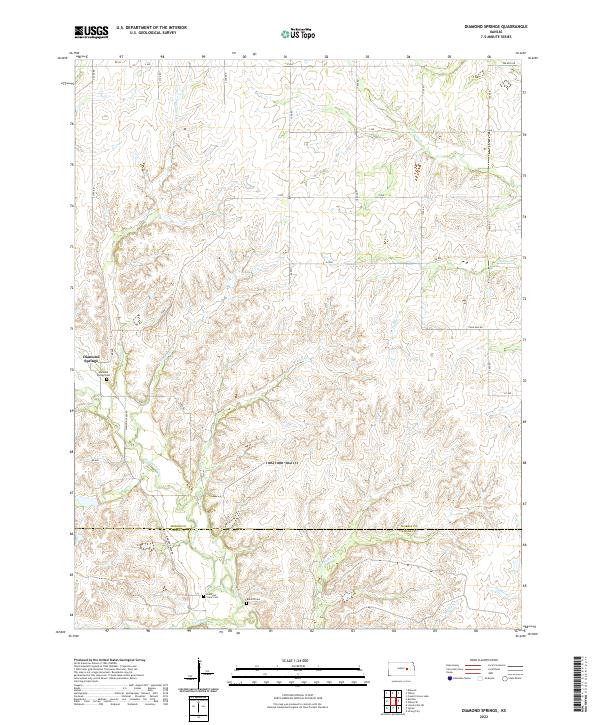
2022 Map of Diamond Springs
USGS Topo · Published 2022About this map
Diamond Springs serves as the focal point of this agricultural and ranching landscape at the boundary of Morris and Chase counties. The area is defined by a dense network of prairie drainage, where Dodds Cr and Silver Cr feed into the larger Diamond Cr system. This 2022 survey illustrates a landscape of established section-line roads like Diamond Creek Rd and Helmick Rd, which navigate the subtle rises between creek beds. For those researching local history, the map provides precise locations for several rural burial grounds, including the Diamond Springs Cem, the Diamond Creek Cem, and the Boenitz Cem situated near Pickett Cr. The naming of School Cr and Fourmile Cr suggests the enduring importance of these waterways in defining the early rural school districts and travel distances across the Kansas plains.
Find a feature on this map
30 named features on this map. Tap any name to fly to it.
Don’t see what you’re looking for? This feature index may not catch every label — zoom into the map to look around manually.
Map Details
Editions of this 2022 Diamond Springs Map
This is the sole edition of this map. No revisions or reprints were ever made.
Other maps of this area

1889 · Parkerville
USGS Topo · 1:125,000

1894 · Parkerville
USGS Topo · 1:125,000

1898 · Cottonwood Falls
USGS Topo · 1:125,000

1955 · Hutchinson
USGS Topo · 1:250,000

1957 · Strong City
USGS Topo · 1:24,000

1957 · Hymer
USGS Topo · 1:24,000

1959 · Hutchinson
USGS Topo · 1:250,000

1970 · Lincolnville NE
USGS Topo · 1:24,000
1971 · Council Grove Lake
USGS Topo · 1:24,000

1972 · Wilsey
USGS Topo · 1:24,000