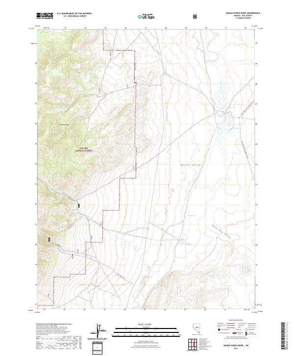
2021 Map of Dianas Punch Bowl
USGS Topo · Published 2021About this map
Dianas Punch Bowl serves as a striking geological landmark within the wide expanse of Monitor Valley, where geothermal activity meets the arid Great Basin landscape. This survey illustrates the sharp transition from the valley floor to the high elevations of the Toquima Range to the west, much of which is protected under the Toiyabe National Forest. The presence of several water sources, including Hot Springs, Mud Spring, and Johnny Potts Spring, suggests the critical importance of these rare features for both local ecology and historical travel through this part of Nye County.
Find a feature on this map
23 named features on this map. Tap any name to fly to it.
Don’t see what you’re looking for? This feature index may not catch every label — zoom into the map to look around manually.
Map Details
Editions of this 2021 Dianas Punch Bowl Map
This is the sole edition of this map. No revisions or reprints were ever made.
Other maps of this area

1926 · Roberts Mountains
USGS Topo · 1:250,000

1929 · Roberts Mountains
USGS Topo · 1:250,000

1955 · Millett
USGS Topo · 1:250,000

1956 · Tonopah
USGS Topo · 1:250,000

1959 · Tonopah
USGS Topo · 1:250,000

1959 · Millett
USGS Topo · 1:250,000

1960 · Dianas Punch Bowl
USGS Topo · 1:62,500

1960 · Wildcat Peak
USGS Topo · 1:62,500

1962 · Tonopah
USGS Topo · 1:250,000
1971 · Dobbin Summit
USGS Topo · 1:24,000