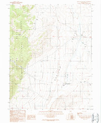
1989 Map of Dianas Punch Bowl
USGS Topo · Published 1990About this map
Monitor Valley defines the eastern expanse of this central Nevada survey, where the desert floor meets the rising peaks of the Toiyabe National Forest. This remote landscape is marked by the unique geothermal activity of Dianas Punch Bowl (Hot Springs), a deep natural travertine cup situated in the valley floor. Water remains the primary shaper of human and natural history here, evidenced by the proximity of Potts Ranch to various water sources such as Johnny Potts Spring and several unnamed seeps. A network of ditches and primitive 4wd tracks connects these isolated outposts across the sagebrush flats. To the west, the terrain becomes increasingly steep as the map traces the drainages of Ikes Canyon, June Canyon, and Black Rock Canyon into the mountain range.
Find a feature on this map
22 named features on this map. Tap any name to fly to it.
Don’t see what you’re looking for? This feature index may not catch every label — zoom into the map to look around manually.
Map Details
Editions of this 1989 Dianas Punch Bowl Map
This is the sole edition of this map. No revisions or reprints were ever made.
Other maps of this area

1926 · Roberts Mountains
USGS Topo · 1:250,000

1929 · Roberts Mountains
USGS Topo · 1:250,000

1955 · Millett
USGS Topo · 1:250,000

1956 · Tonopah
USGS Topo · 1:250,000

1959 · Tonopah
USGS Topo · 1:250,000

1959 · Millett
USGS Topo · 1:250,000

1960 · Dianas Punch Bowl
USGS Topo · 1:62,500

1960 · Wildcat Peak
USGS Topo · 1:62,500

1962 · Tonopah
USGS Topo · 1:250,000
1971 · Dobbin Summit
USGS Topo · 1:24,000