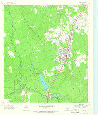
1963 Map of Diboll
USGS Topo · Published 1966About this map
The timber-driven industry of East Texas centers on Diboll in the early 1960s, where the Texas South-Eastern and Southern Pacific railroads converge. The landscape is defined by the proximity of the Davy Crockett National Forest and the intricate wetlands of the Neches River bottomlands. The presence of Fiberboard Lake and various lumber-related infrastructure highlights the town's economic reliance on forest products.
Find a feature on this map
58 named features on this map. Tap any name to fly to it.
Don’t see what you’re looking for? This feature index may not catch every label — zoom into the map to look around manually.
Map Details
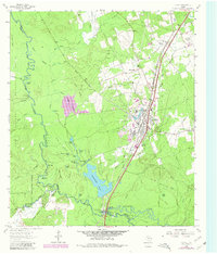
Editions of this 1963 Diboll Map
2 editions found
Other maps of this area

1927 · Lufkin 4-c
USGS Topo · 1:24,000

1932 · Manning
USGS Topo · 1:62,500

1949 · Lufkin
USGS Topo · 1:62,500

1949 · Lufkin
USGS Topo · 1:24,000

1949 · Keltys
USGS Topo · 1:24,000

1950 · Keltys
USGS Topo · 1:24,000

1950 · Lufkin
USGS Topo · 1:24,000

1951 · Wells SW
USGS Topo · 1:24,000

1953 · Palestine
USGS Topo · 1:250,000

1957 · Palestine
USGS Topo · 1:250,000