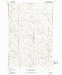
1965 Map of Dice Dam
USGS Topo · Published 1985About this map
Phillips Creek and its various branches, including North Phillips Creek and Middle Phillips Creek, dominate this central Garfield County landscape as it appeared in the mid-1960s. The drainage system is characterized by numerous coulees, such as Tinsley Coulee, Long Coulee, and Knudson Coulee, reflecting a terrain shaped by intermittent water flow and cattle ranching needs. Small-scale water management is evident through features like Dice Dam and Old Stove Dam, which served as critical resources for livestock in this arid environment.
Find a feature on this map
16 named features on this map. Tap any name to fly to it.
Don’t see what you’re looking for? This feature index may not catch every label — zoom into the map to look around manually.
Map Details
Editions of this 1965 Dice Dam Map
2 editions found

Other maps of this area

1954 · Jordan
USGS Topo · 1:250,000

1954 · Forsyth
USGS Topo · 1:250,000

1956 · Jordan
USGS Topo · 1:250,000

1957 · Forsyth
USGS Topo · 1:250,000

1958 · Jordan
USGS Topo · 1:250,000

1958 · Forsyth
USGS Topo · 1:250,000

1964 · Jordan
USGS Topo · 1:250,000

1965 · Black Hills
USGS Topo · 1:24,000

1965 · Kirby Ranch
USGS Topo · 1:24,000

1965 · Darby Buttes
USGS Topo · 1:24,000